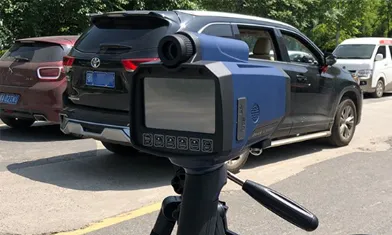


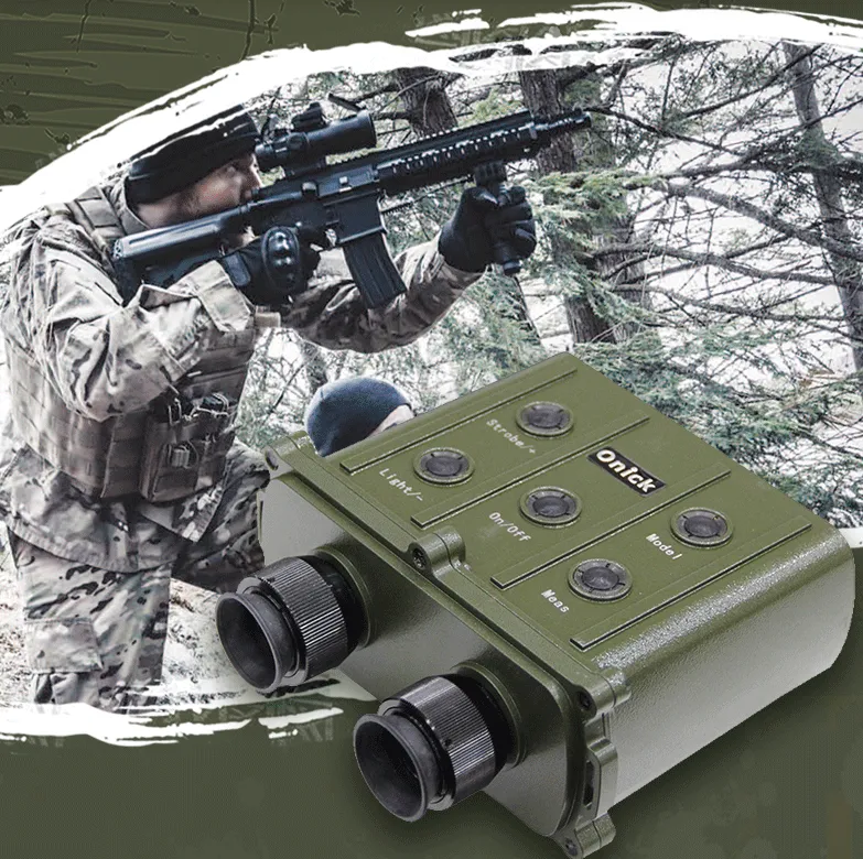
The Military Field Measurement Long-distance Binocular Laser Rangefinder Helps You
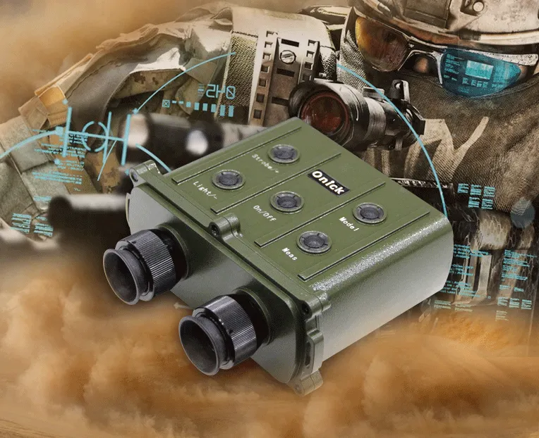
In military missions such as field training, tactical reconnaissance, border patrols, and firepower calibration, accurate distance measurement of distant targets is crucial for ensuring operational efficiency and improving the accuracy of tactical decision-making. The military's dedicated long-range binocular laser rangefinder, with its hardcore performance optimized for military scenarios, has become a "battlefield clairvoyant" for soldiers. Its millisecond-level response and military-grade durability facilitate every field operation.
Based on core military mission requirements, this rangefinder's long-range measurement capabilities have been calibrated for combat use, with a maximum measurement range exceeding 8,000 meters. Even in complex terrain, it can quickly and accurately capture distance data from distant commanding heights, enemy positions, bridges, tunnels, and other key targets, providing crucial support for tactical deployment. Its measurement accuracy meets military-grade standards, with an error strictly controlled within ±0.3 meters. During firepower calibration missions, it can precisely calculate the distance deviation between artillery and target, enabling soldiers to quickly adjust firing parameters and significantly improve their accuracy. In addition, in response to the diversity of the troops' field missions, it is also equipped with tactical measurement modes, such as the "ballistic compensation mode", which can automatically combine environmental factors such as field wind speed and altitude to calculate the ballistic deviation of the bullet's flight, assisting snipers in accurately locking onto targets; the "cluster target ranging mode" can simultaneously measure the spacing and distribution range of multiple cluster targets, transmitting comprehensive battlefield situation data back to scouts.
This long-distance laser rangefinder is easy to use, compact and portable, yet boasts powerful features, including distance measurement, accurate average calculation, and robust data storage. It offers optional azimuth and elevation functions. It is widely used in research institutes, universities, military units, river and waterway systems, benchmarks, telecommunications, cables, geological surveying, meteorology, airports, forestry, and other industries.
Product Features:
Distance measurement accuracy up to 0.5 meters;
Gate function allows for setting a minimum range channel; Average distance measurement function (AGV);
Standard RS232 serial port, also compatible with Bluetooth for PDA and computer data transmission;
Stores and views measurement data, with data transmission, data retrieval, data deletion, and illumination functions;
Optional azimuth and elevation functions display the horizontal and vertical distance to the target, as well as the elevation angle, with a ±45° display range; Azimuth and azimuth are displayed throughout 360°, starting at N000.0° due north and gradually increasing eastward to a maximum of N359.9°;
Applications: Power generation, industry, forestry, security, geological exploration, construction, hunting, camping, and mountaineering.
Technical Parameters:
Model: 6000CI
Place of Origin: Made in China
Release Date: September 2019
Patent Application Number: 202030826525.7
Chinese Brand: Onick English Brand: Onick
1. Ranging Parameters
Range: 30-6000m
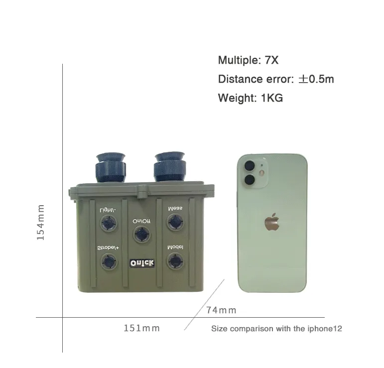
Ranging Error: ±0.5m
Range Gate: 20-5100m (10m Step)
Accuracy: 98%
Repetition Rate: 1/6-1/3 Hz (10-20 times/minute)
Compass Accuracy: ±1 degree (optional)
Tilt Accuracy: ±0.1 degree (within ±25 degrees) (optional)
2. Ranging Function
Calculates average measurement data
Measurement data storage (1000 data points)
Measurement data transmission (output interfaces: RS232, 9600, 8, N, 1)
Display brightness and reticle illumination adjustment
Instrument Lifetime Statistics
Latest Ten Distance Measurements
Serial Number Query
Storage Data Query
3. Optical Parameters
Receiving Aperture: Φ30mm
Scope Field of View: 6.5°
Scope Magnification: 7X
4. Laser Parameters
Wavelength: 1.064μm
Light Source: Nd:YAG
Output Energy: ≥5 mJ
Service Life: ≥20,000 Times
5. Operating Temperature: -20°C to +50°C
6. Environmental Adaptability: Dustproof, Waterproof, and Shockproof
7. Mechanical Parameters:
Dimensions: 151mm*154mm*74mm
Weight: 1 kg
8. Power Supply
① This instrument uses two 3.7V, 3400mAh lithium-ion 18650 batteries. At room temperature, two fully charged batteries provide over 3,000 distance measurements.
Note: After reinstalling the batteries, they must be plugged in and recharged before normal use!
② For charging, plug the power supply output plug into the instrument socket, then plug the power supply plug into an AC 100-240V power source.
Power typically operates in the following two states:
State 1: When the instrument is powered off, plug in the charger. The instrument powers on and displays the battery logo, followed by a flashing battery symbol. When the battery is fully charged, the battery symbol stops flashing. Unplugging the charger automatically shuts down the instrument.
State 2: When the instrument is powered on, plug in the charger. The battery symbol flashes. When the battery is fully charged, the battery symbol stops flashing, indicating full charge. Unplugging the charger does not affect instrument operation.
9. Mounting
The instrument can be mounted on a camera stand using the 1/4 screw hole on the connecting plate at the bottom of the instrument. Alternatively, it can be connected to various theodolites using the dovetail slot on the connecting plate and a dedicated adapter. Remote ranging can be performed using an external trigger cable.
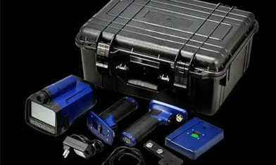
Packaging: Instrument case, rangefinder, 12V/2A power supply, two 18650 batteries, external trigger cable, data cable, instruction manual, warranty card, lens cleaning cloth
This rangefinder is highly adaptable to field environments and easy to use, perfectly meeting the high-intensity mission demands of the military. Crafted from a military-grade, high-strength alloy, it has undergone drop, pressure, and corrosion resistance tests and can withstand extreme temperatures ranging from -40°C to 60°C. It operates reliably even in harsh weather, including rainstorms, dust storms, and snowstorms. With an IPX7 waterproof rating, it can withstand brief immersion in water without affecting its performance. The ergonomically optimized binocular structure, coupled with a non-slip and wear-resistant rubber grip, allows soldiers to perform distance measurement operations with one hand, without causing eye fatigue during extended observation. At night or in low-light conditions, the built-in infrared auxiliary observation system clearly displays target outlines, eliminating the need for additional night vision equipment and meeting the demands of 24-hour field operations. Furthermore, it supports wireless connectivity with military tactical terminals, drones, and other equipment, enabling real-time synchronization of distance measurement data to the command center, enabling seamless integration of "measurement-transmission-decision-making" and significantly improving battlefield response speed.
For troops constantly on the ground, a long-range binocular laser rangefinder is more than just a measurement tool; it's essential equipment for enhancing battlefield survivability and combat effectiveness. Whether surveying terrain during border patrols, conducting tactical simulations during field training, or providing fire support during actual combat missions, its precise, reliable, and durable performance helps soldiers overcome distance limitations, accurately monitor battlefield situations, and provide a strong guarantee for the success of every military operation.